Solutré
Introduction
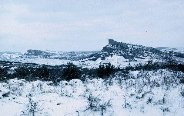
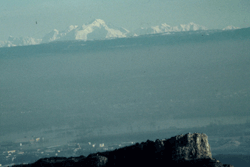
The Paleolithic site of Solutré and the escarpment which protects it from the northwest winds are located a few miles west of the modern city of Mâcon, at the southern Gate of Burgundy where roads (and probably prehistoric trails as well) from the Paris Basin to the north, Belgium to the north-east, and Germany to the east, converge before entering the Saône-Rhône corridor toward the Mediterranean.
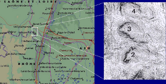
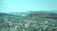
Five cuestas of Jurassic limestone separate the granitic uplands of the Monts du Mâconnais to the west from the alluvial plain of the Saône River to the east. They are from north to south, Monsard, Montagne de St.-Claude (4), Roche de Vergisson (3), Roche de Solutré (2) and Mont Pouilly (1). The small valleys separating the cuestas form natural roads between plain and plateau.
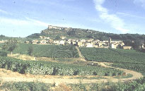
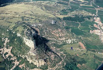
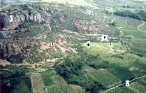
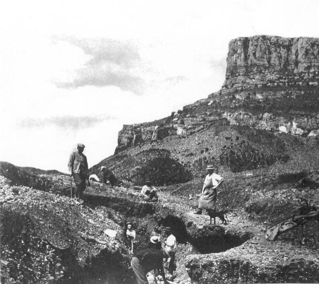
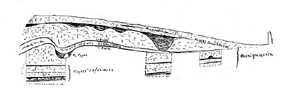
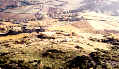
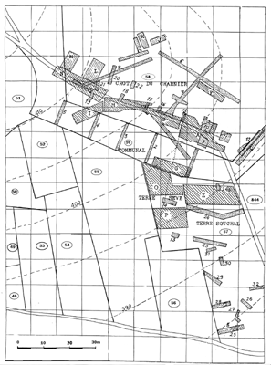
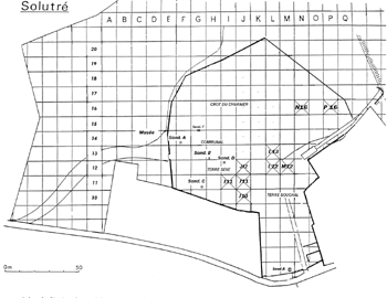
Protected from the dominant northern and western winds, the main site known as Le Cros du Charnier covers an area of more than one hectare, on the south-east side of the Roc. But, Paleolithic remains extend well beyond the limits of the main site. Artifacts were found within and around the modern village and the vineyards of Solutré-Pouilly immediately below the
Cros.
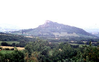
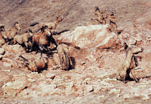
In prehistoric times, it is likely that game herds followed the ravine that separates the Roche of Solutré from the Mont Pouilly in their seasonal migrations between the alluvial Plain and the Uplands. The arched shape of the southern flank of the Roche would then have formed a natural trap where Paleolithic hunters could capture their prey.
Panoramas
Here we have collected some images and QuickTime panoramas to give a tour of the Roche and its surroundings. The tour was realized in 2000 by Janice McLean from photographs taken by Stefan Christiansen with the financial support of the Musée départemental de Solutré. However, the file format is now out of date and we are working to update it.

1860-1920
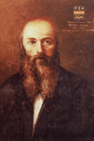
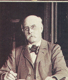
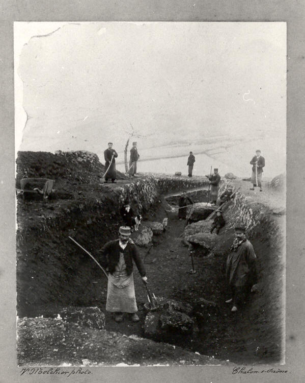
Local people had long been aware of the mass of horse bones above the village, some of it had been was exploited and used as fertilizer before the Cros du Charnier was identified as a Paleolitic site. H. de Ferry, a geologist from Mâcon, found Paleolithic stone tools mixed with the bones in 1866, not long after the scientific community of the time had recognized Boucher de Perthes's claim of humankind's antiquity
He began excavating there with a friend of his, A. Arcelin. They were soon to appreciate the importance of a site so rich in faunal remains and artifacts. Arcelin continued to direct excavations which, for the time, were controlled and well documented.
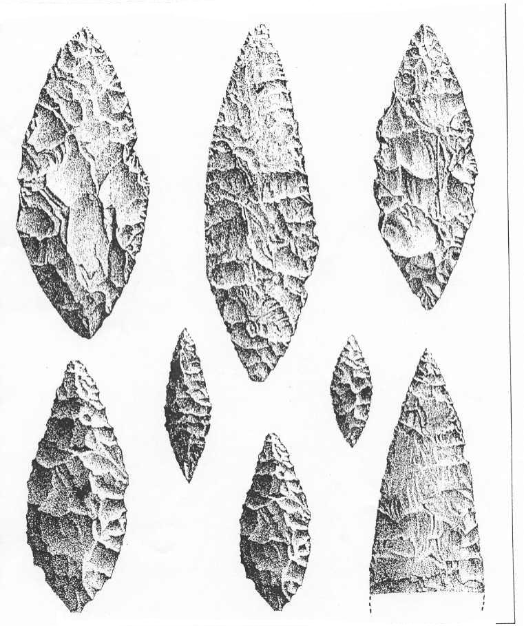
From the time of its discovery to the present, research at Solutré has paralleled the development of the field of Paleolithic Prehistory. G. de Mortillet chose Solutré as the type site of a Paleolithic culture characterized by large bifacially retouched blades, the Solutrean.
The Abbé Henri Breuil excavated a trench in 1907 and used the results of his study of the site stratigraphy to redefine the sequence of Upper Paleolithic cultural traditions.
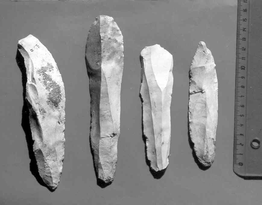
Breuil clarified the sequence of archaeological layers represented at Solutré. He attributed the horse magma to a cultural phase now called the Gravettian and demonstrated that it preceded the layers containing laurel leaf points He also noted that the Solutreans were reindeer hunters. The Solutrean, in turn, was under the more recent Magdalenian layer which contained an abundance of horse bones.
Excavations largely done by amateurs to procure collections of "laurel leaf" points continued until 1926 and contributed to the destruction of large sectors of the site.
1968-1998
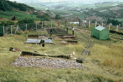
The site was abandoned until 1966 when Jean Combier undertook modern, systematic excavations in areas left intact by earlier trenches which continued until 1976.
The excavations pursued a double objectives . First, redefine and date the successive layers of occupations and establish their environmental context. And second, open an areas large enough to expose the remains and study their distribution to recreate the range of activities practiced at the site by its Paleolithic occupants. The latter goal was achieved with the systematic excavation of a 100 m2 block ofhe Magdalenian layers in P16. Series of test pits provided the kind of stratigraphic data required to fulfill the first objective.
A deep test pit in the area known to contain a deep sequence of deposits in Unit I11was opened in 1986 with the participation of B. Kervaso to complete the geological study of the site.
More recently (1997 and 1998) excavations undertaken in collaboration with the University of Kansas with the participation of J. Hofman and A. Montet-White reopened the I11 test pit and then concentrated on the early Upper Paleolithic components (Aurignacian in Unit M12 and Gravettian in Unit J10).
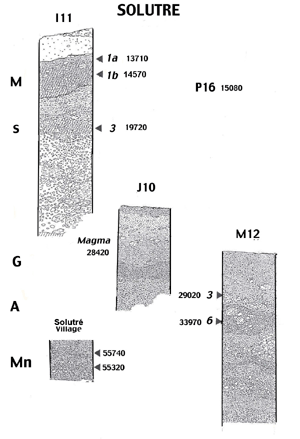
M Magdalenian
S Solutrean
G Gravettian
A Aurignacian
Mn Mousterian
Some 4000 years separate the Solutrean from the earliest Magdalenian occupation found in unit P16. An slmost 8000 year long gap separates the Solutrean from the Gravettian. There is a greater degree of continuity between the Aurignacian and the Gravettian. A long hiatus (20000 years separate theMousterian layers from the Aurignacian.
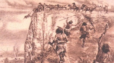
A horse jump site?
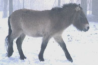
The massive accumulation of horse bones under the escarpment, unique in the archaeological record, baffled specialists and intrigued the general public. Inspired by reports of bison kills in North America, Adrien Arcelin proposed in a novel, an interpretation which attracted a great deal of attention. In the novel, Paleolithic hunters chased horse herds up to the top of the escarpment and forced them to jump to their death.
More recent investigations showed, however, that the masses of horse bones were not under the cliff as could be expected but were in fact on the side and too far to fit the model. More convincing yet, the bones show little if any sign of the multiple fractures which would be there if horses had indeed jumped or fallen from the high cliff.
Recent excavations and modern studies of animal bones were conducted to arrive at a better, more satisfactory interpretation of the horse "magma". Currently accepted view proposes that hunters intercepted animal herds as they moved through the Solutré valley during their seasonal transhumance from the Alluvial Plain of the Saône to the Macônnais Uplands. They forced their prey into natural rock traps along the southern flank of the Roche just under the falt line where they could be slaughtered.
The ambush model best fits the evidence derived from the study of the piles of bones recovered during the excavations. Furthermore, the strategy is adapted to the capture of a wide range of game. Whereas horse was the exclusive prey of the Gravettian and the preferred one of Magdalenian, Aurignacian and Mousterian hunting parties, reindeer was hunted as well; and it was the dominant game of Solutrean hunts in a time period when the colder climate did not support horses.
Hunters' Equipment
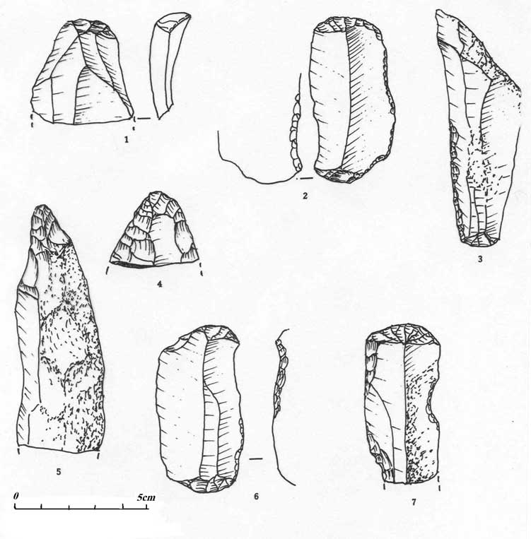
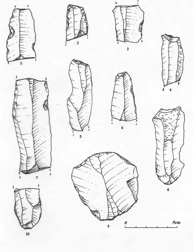
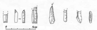
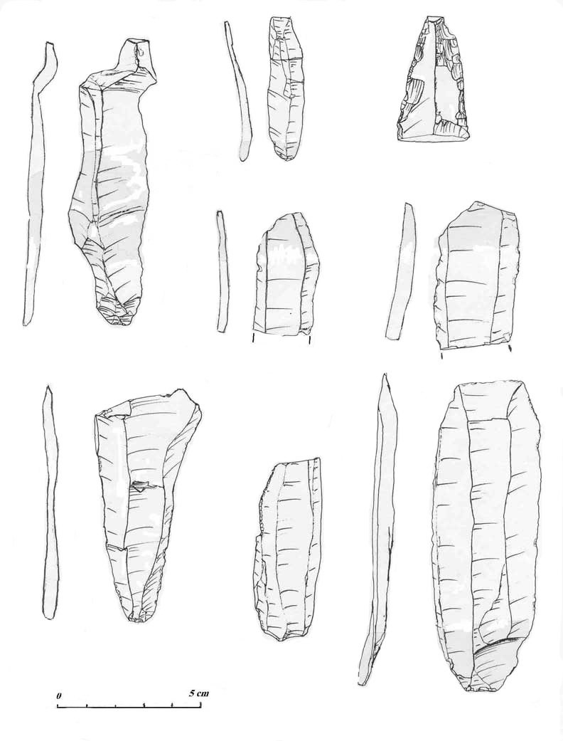
The Neandertals (Mousterian) hunters who came to Solutrë some 50 000 years ago brought to the site large chunks of flint they had collected near La Sénétrière, less than 10 kilometers from the site. While waiting for the game, they prepared cores, drew large flakes and made all the tools they needed. They abandoned on site large quantity of chipping waste and used tools.
The Upper Paleolithic (Homo sapiens sapiens) hunters who began to come to the site around 35000 years ago (Aurignaciens) behaved very differently. They used the same sources of raw material but came to the site with a few cores already prepared; a the site, they drew blades which they transformed as needed into scrapers, burins or knives. They left few debris and some broken tools on the site. They also had spears tipped with bone points and they used shaft straighteners to maintain the spear shafts.
The Gravettian hunting parties came with already made blades and perhaps a few cores. They used the blades as butchering knives, leaving worn and useless tools when they left
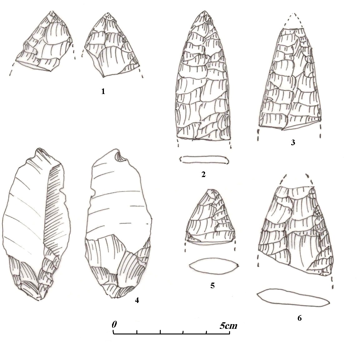
The Solutrean people came in larger groups to camp at Solutré . They made on site quantities of large and small bifacially retouched points which they could use as weapon tips and/or as knives. Small chips, debris of the bifacial point s manufactures, littered the site.
The Magdalenian came with prepared cores and some large blades. their tool kits were more differentiated, containing a variety of tools for cutting meat, preparing, cutting and sewing hides.
Little is known of their weapons and actual hunting techniques beyond the general models discussed above.